|
Lexical NOAA/HRPT and FY-1D/CHRPT Solutions for PAGASA, Philippines. |

|
Lexical Technology Pte Ltd |
|
Your Partner In Remote Sensing Solutions. |


|
Lexical had successfully installed and commissioned a new NOAA/HRPT and FY-1D/CHRPT system at the Philippine Atmospheric, Geophysical and Astronomical Service and Administration (PAGASA) in September 2006 In-tandem with the primary mission of PAGASA to provide protection of life and property against natural hazards due to typhoons, floods, drought, giant waves, high seas, etc., to utilize scientific knowledge and information as an effective instrument to ensure the safety, well being, economic security and improve the quality of life of all the people and the environment; and to promote national progress and contribute to regional socio-economic development through various applications of meteorology, geophysics and space sciences (including astronomy), Lexical is the preferred partner. |
|
18 Nov 2006 |
|
In order to track and monitor natural hazards, especially due to typhoon, PAGASA requires satellite data from the polar-orbiting satellites passing over it. The consequence of having such a large array of polar-orbiting satellites passing over PAGASA (which averages to about 1 pass per hour) is that PAGASA has to have a scalable and robust system that can handle such high volumes of data. A single Lexicalís NOAA/FY-1D system is capable of receiving data from NOAA 12, 15, 16, 17, 18 and Chinese FY-1D polar orbiting satellites hence eliminate the needs to install multiple systems. This enables cost to be significantly minimized. This is much accredited to Lexical SatFEPS. SatFEPS can detect schedule conflicts between satellites and make automatic decisions to receive data from only one of the satellite passing over. |

|
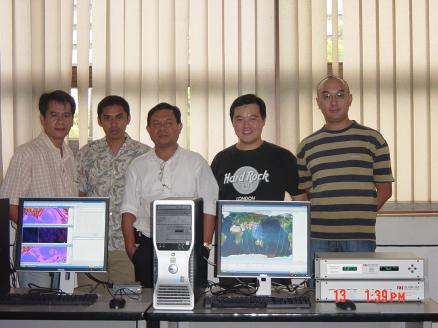
Personnel from PAGASA and Lexical |

|
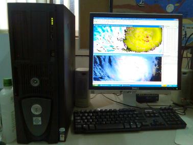
Lexicalís system in action |
|
Pre-processing of ingested data is also taken care by Lexical SatFEPS. The pre-processed raw data is then projected and viewed by Lexical SatVISUAL installed on Usersí Terminals. Using SatVISUAL, level 2 products can be produced in a timely and efficient manner. With Lexicalís NOAA/FY-1D system in place, BMG can now make use of high resolution data from NOAA and FY-1D satellites to monitor the regionís climate effectively. |